News
- Tags: Office Market News,
- Author: Admin STS,
- Date posted: 26/06/2025
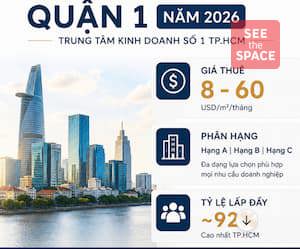
Development planning according to 6 sub-zones HCMC
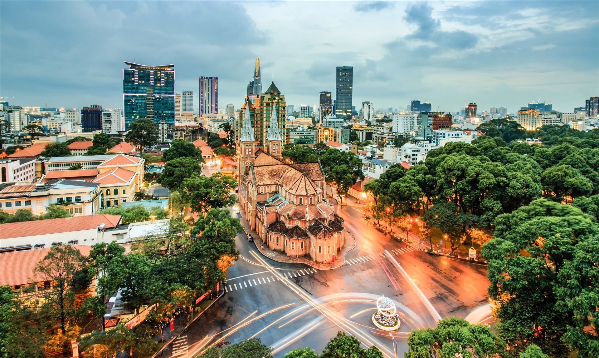
The project identifies the goal of Ho Chi Minh City as a global, civilized, modern, and humane city with a level of development on par with major cities in the world. Ho Chi Minh City is the economic, financial, and service center of Asia, playing the role of a growth pole and a driving force for development in the South and the whole country. The city is an area with a high standard of living and quality of life; a distinctively developed cultural economy, attracting international financial institutions and economic groups.
This planning continues to orient the spatial axes and development corridors of the City according to:
- 4 directions: East, South to the sea, West - North and West, West - South.
- Develop new spatial axes such as 4 axes in the North - South direction; Saigon River - Huynh Tan Phat axis; National Highway 22 - Truong Chinh - Cach Mang Thang Tam - Nguyen Huu Tho
- Form new development corridors such as the development corridor along the Saigon River. Organize routes along the Saigon River to connect ecological urban spaces; develop large-capacity public transport routes. Form a coastal economic corridor.
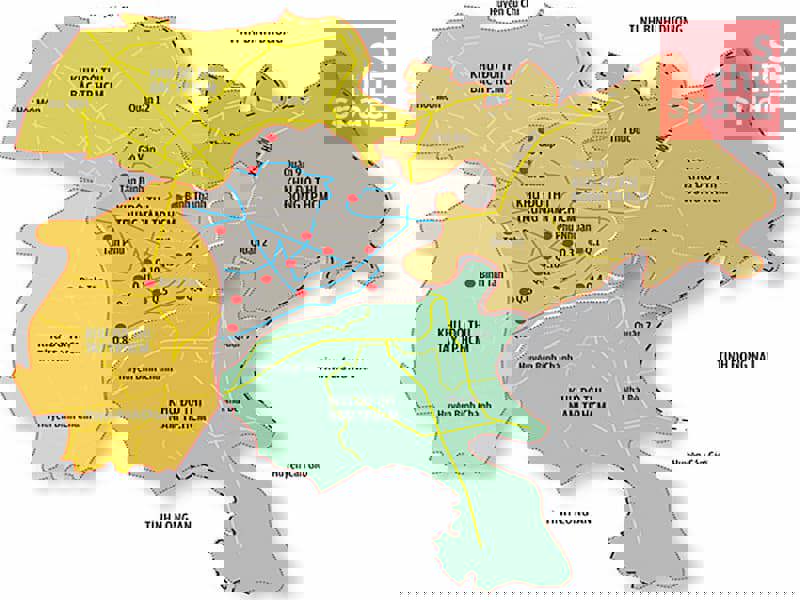
1. Central City: the center
- Area: Saigon - Cho Lon core area
- Role: administrative, commercial, service, knowledge-based economic and tourism center. This place will preserve architectural heritage, reduce residential density, and increase building height.
- Area: 172 km2, population by 2040 is forecasted to be 5.4-6.05 million people
The development orientation of this area is to preserve the old urban structure, preserve the architectural and cultural heritage of the City to become a regional and national cultural and tourism center. Encourage the direction of increasing land use coefficient, reducing density, increasing building height, and controlling residential density.
2. Cu Chi - Hoc Mon Urban: the Northern subdivision
- Area: includes Cu Chi and Hoc Mon districts and the northern part of District 12.
- Role: will be an urban area of services, resorts, entertainment and eco-cultural tourism. Infrastructure will be renovated along National Highway 22, developing an urban strip along the Saigon River.
- Area: 579 km2, population of about 2.5-3.15 million people
This will be a service, entertainment, cultural, resort, health care urban area interwoven with agricultural landscapes. Forming industrial, educational, training, technological zones, agricultural production support zones and eco-cultural-historical tourism
3. Binh Chanh urban area: the Western subdivision
- Area: North of the central urban area and part of the southern area - the part located west of Can Giuoc River of Binh Chanh district and the part west of National Highway 1 in Binh Tan district today
- Role: this area is an industrial, commercial service, technology and health care service urban area, biomedical and pharmaceutical center, education and training
- 233 km2, population of 1.55-1.86 million people
Main orientation, prioritizing the development of key areas of industry, logistics and clean, high-tech production complexes; medical services associated with health care and vocational training.
4. Urban District 7 - Nha Be: the Southern subdivision
- Area: South of Kenh Doi in District 8, the area east of Can Giuoc River in Binh Chanh District, District 7 and Nha Be District today
- Role: Main development orientation, prioritizing the development of key areas of industry, ports; research - training and production centers according to advanced, high-tech models.
- Area: 194 km2, population of about 1.8-2.2 million people
At the same time, supplement and complete the public transport system and the main and regional traffic network. Ensure traffic connection within the region and to the northern and eastern regions.
5. Can Gio Urban Area: the Southeast subdivision
- Area: the entire current Can Gio district
- Role: The development orientation of this sub-area is to protect and promote the value of the Can Gio biosphere reserve area and the mangrove ecosystem; develop space according to the ecological urban model, emphasizing the elements of canals - water urban areas and coastal urban areas, facing the sea.
- Area: 732 km2, population of about 0.5-0.6 million people
6. International Financial Center: the Eastern subdivision
- Area: Thu Duc City
- Role: The development focus is Thu Thiem, Truong Tho - Rach Chiec and Long Phuoc - Tam Da.
- Area: 211 km2, population by 2040 is about 2.2-2.64 million people
Prioritizing the development of key areas in finance, trade - services, culture, sports, research, training and high-tech production. In particular, the International Financial Center is oriented to develop in the Thu Thiem area. The main center of the Thu Duc urban subdivision is organized in the Truong Tho - Rach Chiec area and vicinity; The support center is organized in the Long Phuoc - Tam Da area.
Contact SEE THE SPACE today for the most effective support
- Phone: 0768 999 647
- Email: leasing@seethespace.vn
- Website: seethespace.vn
Categories
Hot News
-
 China+1: Which Provinces Are Winning Vietnam's FDI Race in 2026?
 -
 Northern Vietnam Industrial Parks 2026 | FDI & Industrial Land Opportunities
 -
 Ready-Built Factories for Lease 2026: Industrial Leasing Solutions in Vietnam
 -
 District 1 Office for Lease in 2026: Rental Rates, Occupancy & Leasing Guide
 -
 District 3 Office for Lease 2026 | Rental Rates, Building Grades & Expert Advisory
 -
 HCMC Office Market 2026: Strategic Opportunities for Tenants
 -
 Private Offices in Coworking Spaces: The Optimal Solution for 2026
 -
 Dong Nai City Launches 10 New Urban Wards: Opportunities in 2026
 -
 Industrial Parks in Long An, Binh Duong, and Dong Nai 2026: A Comprehensive Investment Guide
 -
 River-View Offices in Ho Chi Minh City 2026